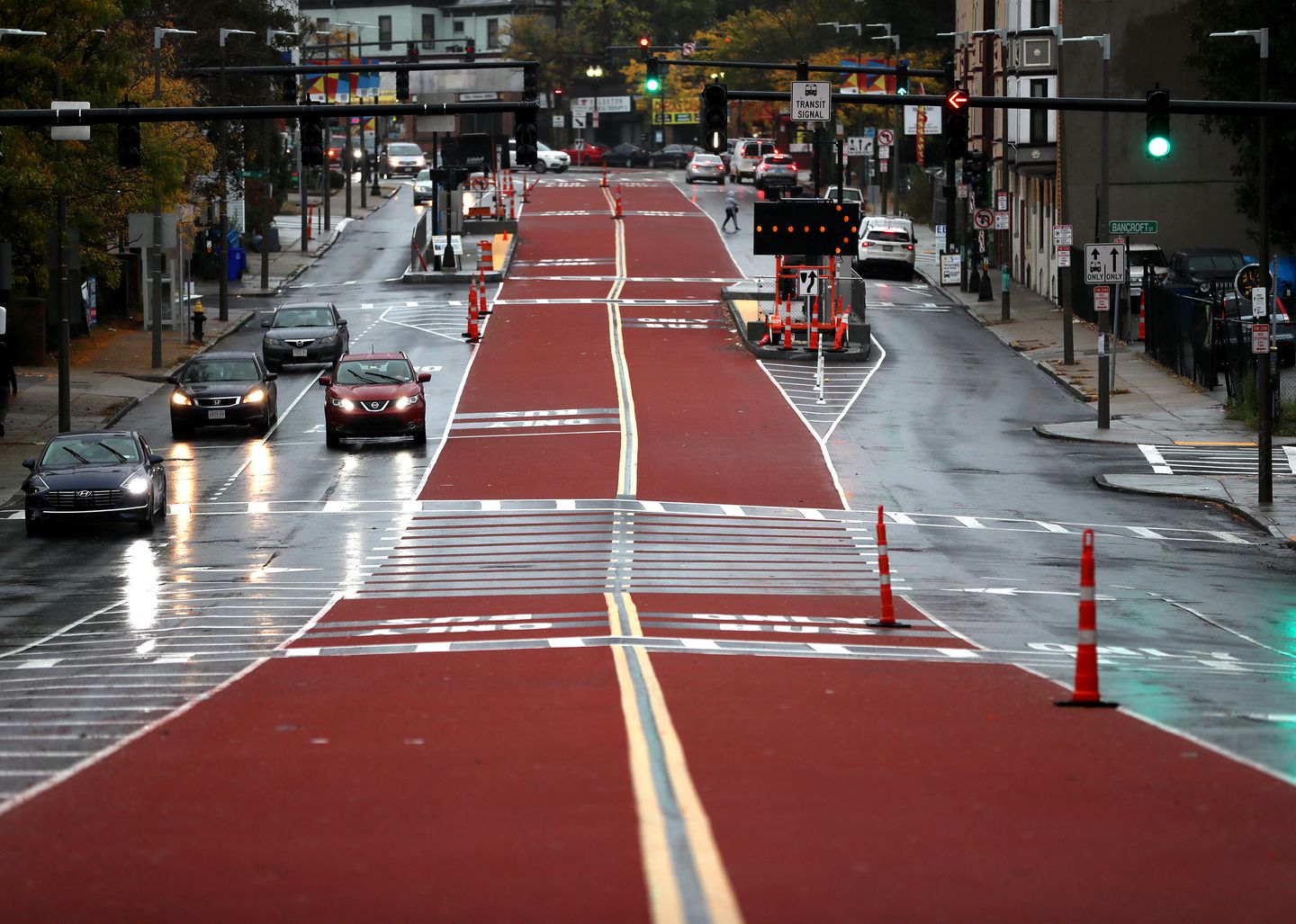
LYNN – Center-running bus lanes are a new feature of New England’s transportation infrastructure. They started operating on Columbus Avenue in Boston at the end of October, and now the Lynnway is one of the two locations in the state vying to be chosen as the next site.
“Lynnway is designed and built for cars; it is not a human-friendly street,” said Aaron Clausen, the city’s principal planning director.
The joint, state-backed project responsible for center-running bus lanes would introduce the feature along with a shared-use path to a 1.5 mile-long stretch of Route 1A from Central Square at Lynn Station to the General Edwards Bridge. It will create a faster transit between the Commuter Rail in Lynn and the Blue Line at Wonderland Station in Revere and will make buses operate more like light-rail transit, Clausen said.
All bus stops will have Americans with Disabilities Act (ADA)-compliant bus-boarding platforms and have lit bus shelters. Redesigned, well-marked pedestrian crossings with physical bump outs and/or barriers for protection will make pedestrians more visible, which will make it safer for pedestrians and cyclists to cross and access transit, said Clausen.
“Right now, it is an afterthought,” said Clausen. “There are not many crossings so right now people are forced to cross mid-block.”
Proposal to reconstruct this stretch of the Lynnway appeared in the Lynn Transit Plan finalized by the Massachusetts Department of Transportation (MassDOT) and the Massachusetts Bay Transportation Authority (MBTA) in July 2020. In July 2021, the Massachusetts Department of Conservation and Recreation (DCR) that owns that section of the Lynnway joined MassDot and the MBTA to apply for the federal Rebuilding American Infrastructure with Sustainability and Equity (RAISE) grant.
“DCR, MassDOT, MBTA and the city share similar vision,” said Clausen. “We all recognize and agree that Lynnway is not acceptable as a roadway where it stands now. It is not what we need on our waterfront, it is not what we need in terms of transportation infrastructure.”
The state agencies requested $11,268,750 worth of funding from the U.S. Department of Transportation via the grant. The total costs of the project are estimated at $15,025,000. The Commonwealth of Massachusetts will provide the remaining 25 percent of funding, according to the RAISE grant application. The costs include construction, as well as planning and design.
The center-running bus lanes will replace roadway space currently dedicated to general-purpose traffic, reducing the Lynnway from six-seven lanes to two general-purpose lanes in each direction and additional turning lanes at appropriate intersections. This will eliminate conflicts between buses and right-turning vehicles, provide pedestrians with more marked crossings, decrease the number of lanes they have to cross, and help to slow traffic.
Currently, three MBTA bus routes, 439, 441 and 442, connect Lynn to Wonderland Station through Route 1A, serving approximately 7,600 bus passengers daily on the corridor from 6 a.m. to 8 p.m., according to MassDOT’s RAISE grant application.
Many Lynn residents use the bus or drive to Wonderland Station to access jobs in Boston or Logan International Airport. According to MassDOT, a high rate of households with no cars and households with incomes below the poverty line live in Lynn’s downtown area, close to Lynn Station in Central Square. Buses are an important, affordable transit option to such Lynn residents.
A one-way Commuter Rail ticket to Boston costs $7, while taking a bus to Wonderland Station and riding the Blue Line into Boston costs either $2.40 or $4.10, depending on payment method.
Modification of the Lynnway promises to make buses more reliable, shorten each bus trip by up to six minutes and allow MBTA to provide more bus trips with the same number of vehicles. The center-running lanes could be also used for school buses and emergency-response vehicles. The project would add green space along the Lynnway and provide a separate, shared-use path for bicyclists and pedestrians, located most likely on the waterfront side of Lynnway, Clausen said.
Moreover, there are currently plans to possibly convert unused industrial and commercial land along the Lynnway into mixed-use developments including over 4,000 residential units as well as plans for similar growth along Route 1A in Revere, which was already listed as one of the most consistently congested corridors in Massachusetts in MassDOT’s “Congestion in the Commonwealth: Report to the Governor 2019.” Further development along the route will lead to further worsening of the congestion if this corridor is left unimproved.
The RAISE grant application anticipates completion of the project in 2024; however, Clausen finds such a timeline premature.
“If we were to do a complete reconstruction of Lynnway that would be transformative. That’s a large project,” said Clausen.
In his opinion, only design and engineering work would take one to two years. Clausen expects to hear about the RAISE grant application by the end of November.
The other location in the state where MBTA is planning to introduce center-running bus lanes is Blue Hill Avenue in Boston between Mattapan Square and Warren Street, according to the Boston Globe.