LYNN — After nearly seven months of working with the community and reviewing past plans, updates to the city’s hazard-mitigation plan were presented during a virtual public meeting on Wednesday night.
The plan includes measures to deal with inland and coastal flooding and coastal erosion. Some of these measures include promoting and implementing green infrastructure, low-impact development and climate-change-resilience solutions.
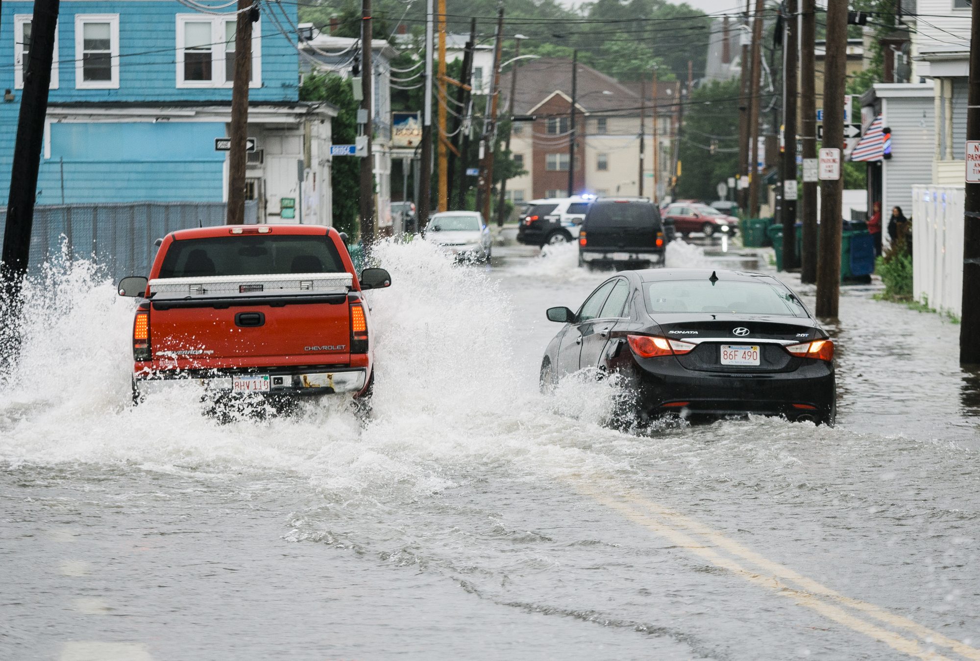
Updates to flooding in the plan also include evaluating and implementing stormwater and flood-mitigation solutions on city-owned properties, and upgrading and maintaining drainage systems on Route 1A, downtown and the Boston Street area.
In regards to coastal flooding and erosion, the plan includes protecting and enhancing the resiliency of the pier and marina, installing a wave attenuator to protect the marina, mitigating shoreline erosion, and studying the Saugus River to come up with strategies for reducing flooding, erosion and the effects of extreme heat and water quality.
Van Du, a senior environmental planner for the Metropolitan Area Planning Council (MAPC) who worked with the city to develop this plan, said Lynn’s location is highly susceptible to hazards like flooding and winter storms.
In order to receive funding from the Federal Emergency Management Agency (FEMA), the city needs to update its hazard-mitigation plan every five years and incorporate climate-change considerations.
“Once the plan is approved and adopted (by FEMA) and the city, it will keep Lynn in good standing for the next five years,” Du said.
The updates to the plan also include ways to deal with severe winter storms by evaluating facilities with the ability to withstand snow loads; deal with droughts by promoting rain barrels and drought-resilient landscaping; and deal with extreme heat and heat waves by developing tree-planting guidelines for developments, increasing street planting, and conducting an urban-forestry-management plan.
“More frequent summer and fall droughts are anticipated due to earlier snow melts and less rain in those seasons,” Du said. “We’re also thinking about extreme heat, which is anticipated in this region.”
The MAPC predicted rises in sea levels, which is another topic in the plan, that will impact the city, saying that the levels will rise by 1.2 feet by 2030, 2.4 feet by 2050, and 4.2 feet by 2070.
The plan also includes implementing opportunities for providing communication and temporary shelter to vulnerable populations, such as the elderly, low-to-moderate-income residents, the homeless, immigrants, disabled people and the transient.
The updated hazard plan will be posted online this week and the public will have until Jan. 19 to review and comment on it.
To view the plan online, visit the city’s planning board website at www.lynnma.gov/boards/planning.shtml.
After that, the draft will be submitted to FEMA and the Massachusetts Emergency Management Agency (MEMA) for review, and revisions will be made if needed.
Once approved by FEMA and MEMA, the city will vote to adopt the plan.
When the city approves it, the plan will be in effect for five years and the city will be eligible for FEMA mitigation grants.