LYNN – More than 50 people accepted the City’s invitation to come to its community meeting Tuesday at Grace United Methodist Church to discuss the Federal Emergency Management Agency (FEMA) map updates, which happen every 10 years and will go into effect July 8 regardless of City approval.
Tuesday’s meeting was designed to inform residents about the FEMA process and their appeal rights regarding the updated floodplain maps.
The new maps showcase Special Flood Hazard Areas (SFHAs), which are also known as the 100-year or 1% annual chance of floodplains. SFHAs are where floodplain management regulations are enforced and where the mandatory purchase of flood insurance applies.
Before Tuesday’s presentation began, Ward 1 councilor Dr. Peter Meaney shared his thoughts.
“My personal feelings on this situation is: I think FEMA is basically a Ponzi scheme, and they’re looking to compel new people to buy into their insurance. That’s how I feel. I’ll leave it at that,” Meaney said.
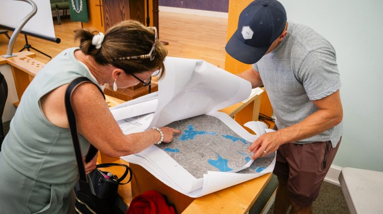
Principal Planning Director for the City Aaron Clausen led the presentation as well as the question and answer segment that followed. Clausen explained how the new maps can be interpreted, using a provided key.
He also explained that, as part of the Pickering Building project, the City requested a map revision around Flax Pond, arguing that the underlying data was faulty. Due to that revision request, certain parcels will be removed from the SFHA and others will now have a reduced impact, but there are still parcels that will be affected. When asked how many parcels would be affected, the answer was “less than 40.”
Regarding how those parcels will be affected, three impacts were directly mentioned in the presentation:
- “Building code: New construction or substantial improvements will need to meet state building code requirements for flood-resistant construction.
- Permitting: Construction activities (e.g., tree removal, Earth disturbance, decks or patios, etc.) in the SHFA require a permit from the Conservation Commission under state and local wetlands protection laws.
- Flood insurance: Federally-backed mortgages will require flood insurance, which is generally not included in a standard homeowners insurance policy.”
Many community members shared their frustrations that the City had not effectively communicated information about the FEMA map updates to those who would be affected. Jon Thibault, Mayor Jared Nicholson’s chief of staff, said, “the criticism about the lack of engagement is fair and understood.”
Community members do still have the ability to request a Letter of Map Change. One way to go about this is with a Letter of Map Amendment (LOMA), “which basically what you’re showing and documenting for FEMA is that the building is above the base flood elevation, so you don’t have flood risk to the level of that 1% every year.”
To do that, parcel owners would need to contract a surveyor or civil engineer to document and submit that application. Community member and civil engineer Paul Starratt spoke up during the question and answer portion of the meeting to share his advice.
“If you feel as though the elevation of your house is higher than what they are saying is the control elevation of the flood map, if you truly believe that, then there is an opportunity for you to get a Letter of Map Amendment or a Letter of Map Change,” Starratt said. “I would not recommend a surveyor because they’re not going to answer the phone. They’re too busy. But an engineering firm, you have to be a registered professional engineer to stamp a Letter of Map Amendment… I recommend you (use an engineer) as a group.”
Starratt explained that if a group from a neighborhood were to call a civil engineer together, they would get a discounted rate as a group rather than the full bill individually.
“FEMA is doing this. It’s done. What your opportunity is is to try and get a reduction,” Starratt said. “The last word of caution is that if you’re wrong, and that engineer comes back and tells you (you’re in the floodplain), you still got to pay the engineer, so you want to be certain and confident that your property is, in fact, above what FEMA is claiming.”
For community members who would like to check if their property is in an SFHA, visit tinyurl.com/Lynn-Floodplains and input an address to see.